

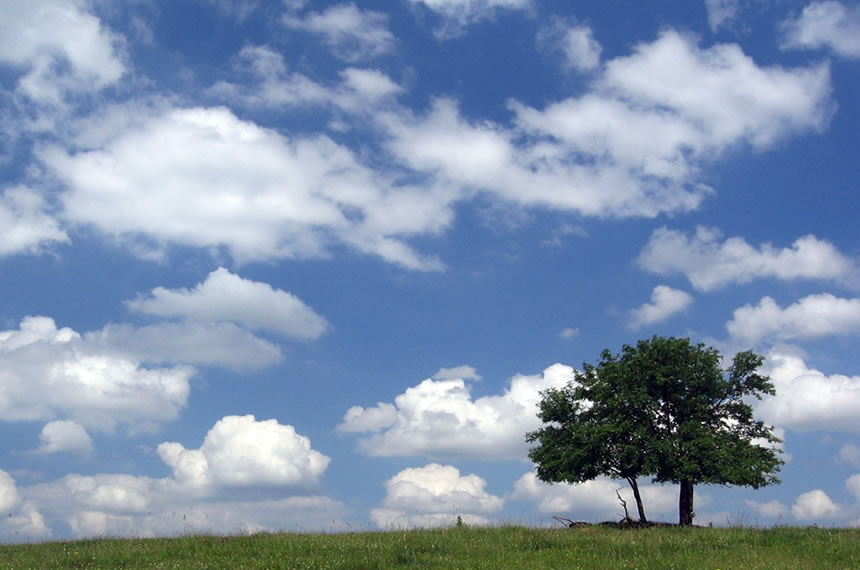
Clouds come in many shapes and sizes. Sometimes they look like large, white and puffy cotton balls lazily hanging in the summer sky. Other times they are giant, angry, dark and towering high above the Earth’s surface. They all have one thing in common though, are all made up of the same element: water.
Facts about Clouds
- Clouds are made from water that evaporated into the air and then condensed again into tiny water droplets or ice crystals
- Most clouds are found within the troposphere, the lowest layer of the Earth’s atmosphere. This layer contains the majority of the atmosphere’s water vapor.
- They are an essential part of the water cycle. Rain and snow that fall from clouds replenish lakes, streams and rivers.
- They can be divided into 4 groups based on their appearance: Cirrus, Cumulus, Nimbus and Stratus
- Clouds can also be divided into 3 groups by their altitude above the Earth’s surface: Lower Level, Mid Level and Upper Level
How do clouds form?
In the water cycle, water in lakes, streams, rivers and oceans evaporates into the air when temperatures rise high and the air outside gets warmer. As water evaporates, it becomes water vapor, the gas form of water.
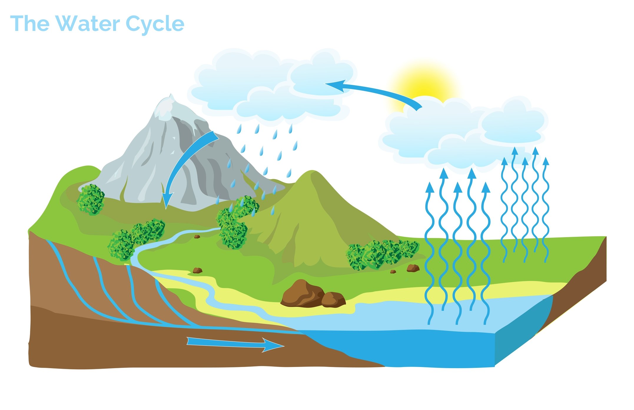
Water vapor is lighter than the air around us, so it rises up into the atmosphere. As it goes higher and higher, the temperature of the air around the water vapor begins to drop.
Once the temperatures drop low enough, the vapor starts to condense. This means that the gaseous vapor will begin to turn into a liquid or solid again. Once enough condensed water molecules group together, they form clouds.
What are clouds made of?
Clouds are made of thousands of tiny water droplets or ice crystals that condensed from water vapor. The water droplets and ice crystals will eventually fall back to Earth as rain, sleet, snow or other precipitation.
Why are clouds white?
Clouds appear white because the water droplets that make up the cloud are scattering light in all directions. As all of the colors of the light spectrum are being scattered at once, our eyes “see” the color white.
Some of the light from the Sun penetrates through to the bottom of clouds, where the water droplets are larger and scatter less light. This gives the bottoms of clouds a gray and darker appearance, while the tops are whiter and brighter.
How are clouds classified?
Clouds are generally classified in one of two ways: by appearance or by altitude (height) above the Earth.
When they are classified by appearance they are broken down into four categories with Latin names. These categories are listed below along with their meanings.
Cirrus (curl or ringlet of hair)
Cumulus (heap or pile)
Nimbus (cloud, dark cloud or fog)
Stratus (layer or spread)
When classified by altitude above the Earth they are broken into three categories:
High Level (Cirrus, Cirrostratus)
Mid Level (Altocumulus, Altocumulus)
Lower Level (Cumulus, Stratocumulus)
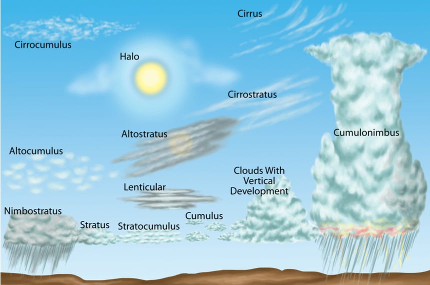 Diagram of Cloud Altitudes
Types of Clouds
-
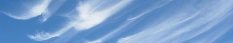
Cirrus

Of all the cloud types, cirrus are found at the highest altitudes above the Earth. They are approximately 20,000 Feet above Sea Level and higher. This area is called the upper troposphere.
Temperatures at these altitudes are very low, and are usually below -30°C (-22°F). Due to these low temperatures, these clouds are formed entirely of ice crystals, giving them an airy, streaky appearance.
-
Cirrostratus
Cirrostratus are found near similar altitudes as Cirrus types, at about 18,000 feet above Sea Level.
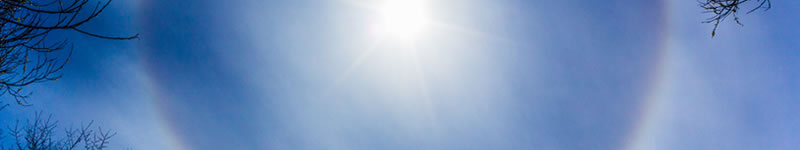
Cirrostratus are often difficult to see. When they are visible, they will appear as thin, fibrous sheets that stretch across large areas of the sky. A thickening of cirrostratus clouds usually means that precipitation is coming soon.
When moon or sunlight shines through these clouds, it will sometimes refract off of the ice crystals and form halos.
-
Altocumulus
Altocumulus are clumped or heaped clouds located within the mid-level group of clouds between 6,500 feet and 20,000 feet. They are usually clustered with many other Altocumulus, where Cumulus clouds will often have more space between them.
Altocumulus generally appear in rows or large clusters. They will be white or light grey in color. Both Altocumulus and Altostratus may signal a cold or warm front is approaching.
-
Altostratus
Altostratus are part of the middle group of cloud types. They are located at elevations of 6,500 – 20,000 feet, and form ahead of warm and cold fronts.
Altostratus fill wide swaths of the sky, or the entire sky. They appear as a slightly thicker layer of cloud, and are light grey to grey in color. Altostratus generally have few features, but may have small bumps or waves in them.
These clouds often precede a frontal system. As the system approaches, they will begin to descend to lower altitudes. If they begin to precipitate rain or snow that falls to the ground, they become classified as Nimbostratus. Seeing Altostratus types in the sky is an indicator that rain or snow is on its way.
-
Nimbostratus
Nimbostratus are dark grey middle group clouds, with bottoms lower than 6,000 feet (1830 meters). They are often formed when altocumulus types descend as a warm front moves through an area.
Nimbostratus have less definition than other types, because moderate to heavy amounts of rain or snow are being precipitated from the bottoms of the clouds. As the precipitation falls, the bottoms and sides of Nimbostratus may appear hazy or foggy.
-
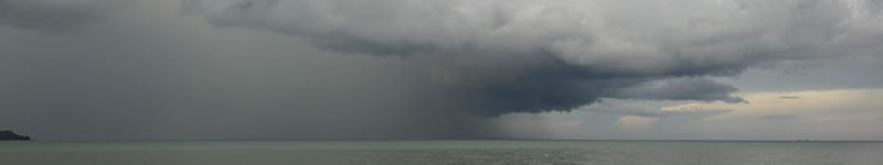
Cumulonimbus
Cumulonimbus are the ominous thunderhead clouds that stretch from the lower levels of the atmosphere to the high altitudes of the upper troposphere and lower stratosphere.
The bottoms of these are usually dark gray, where substantial amounts of water vapor and rain collect. The tops of these towering behemoths will be a lighter white color, and often resemble anvils.
In tropical areas, cumulonimbus can reach as high as 15 kilometers (9 miles) above the surface of the Earth. Cumulonimbus can produce lightning, thunder, hail and tornadoes.
-
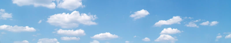
Cumulus
Cumulus are the white, puffy types that people usually think of when they think of clouds. They are seen on beautiful days, and appear to slowly drift across the sky. Cumulus are made of water droplets and water vapor, but not enough to fall as rain.
-
Stratocumulus
Stratocumulus are one of the the lowest level types of clouds, found at altitudes below 6,000 feet.
They usually appear in clumps, clusters, lines or as a layer as opposed to cumulus which often appear alone in the sky. They are also darker than cumulus and may form light rain or snow.
Stratocumulus can be classified into sub-groups depending on these characteristics, and whether breaks appear between the clumps or not. Stratocumulus clumps are about fist sized, where altocumulus clumps are roughly the size of a penny or dime.


Clouds in Film and Literature
- In the opening sequence of the 1964 Film “Mary Poppins”, Mary is seen sitting on clouds over London
- “Both Sides, Now” was a song released by Joni Mitchell in 1968 with substantial references to these phenomena in the lyrics
- Software and servers that store data in locations that are physically separate from local users are referred to collectively as “The Cloud”
- In 1983, a superhero named Cloud joined “The Defenders”, a Marvel Comics superhero team that included Hulk and Dr. Strange
